Massive, red rock walls rise from the desert floor as rivers and creeks snake through the canyon landscape, creating dramatic canyons, beckoning one to explore refreshing swimming holes for a cool mid-day dip. Looking around, the scenery looks like Utah’s red rock country, but is actually the western edge of Colorado.
Breaking out from my normal rotation of desert destinations after a long, cold winter, I stumbled upon Dominguez Escalante National Conservation Area (NCA) when I was looking for a warm spring getaway. I’ve driven past this unassuming stretch of Hwy 50 dozens of times before, but it wasn’t until I dug a little deeper that I found the beauty hidden from within.
Located 22 miles south of Grand Junction, the landscape from the highway consists of grass plains and a few juniper-pinyon trees. Venture off the road into the 200,000-plus acres of protected land to find Dominguez Escalante’s family-friendly outdoor playground to experience by foot, raft or motorized vehicle. Mellow hiking trails, flat roads and an easy float make this a perfect destination for families of all ages.
Outdoor adventure isn’t the only draw to the area. Canyon walls are marked with petroglyphs from Native Americans that date back thousands of years. It wasn’t until the late 1800s that settlers moved into the area and used it to graze cattle. Many of the historic cabins are still standing today.
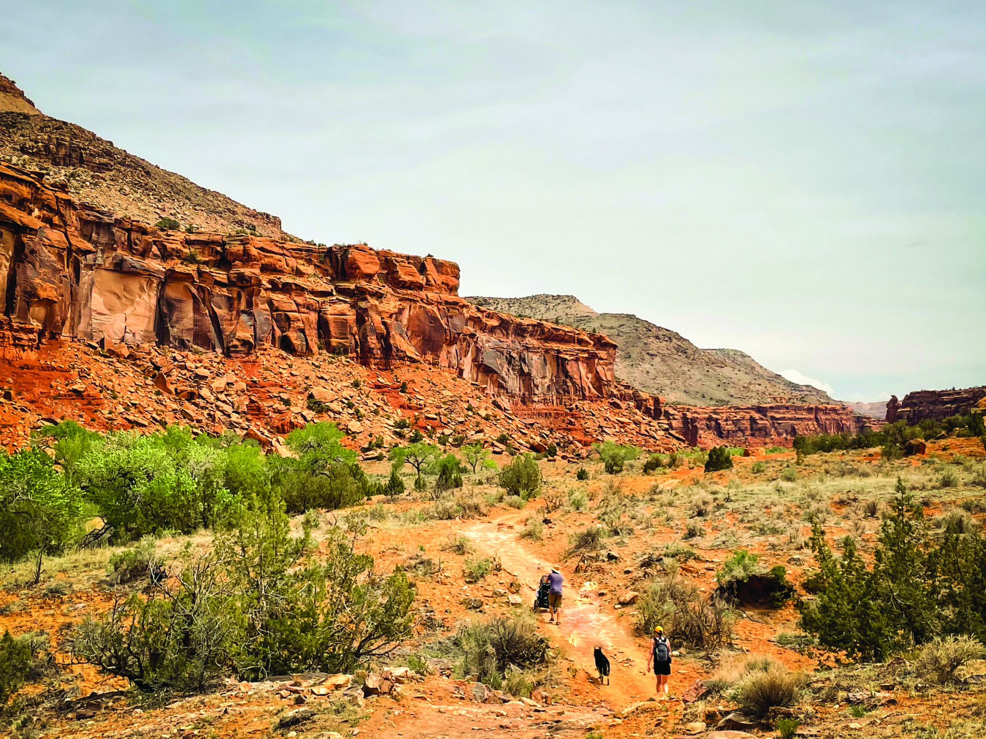
Big Dominguez Canyon is a 13-mile through-hike popular with backpackers or as an out-and-back trail for day hikers. The best way to experience this hike is to pack for the day with lunch and a bathing suit for a swim in one of the pools.
It’s an easy trail that is mostly flat, wide and smooth, with a few rocks along the way. We’ve taken kids in backpacks and an off-road Burley stroller, which was able to navigate a majority of the trail. While the trail is relatively easy, the heat can become crippling with no shade along the way.
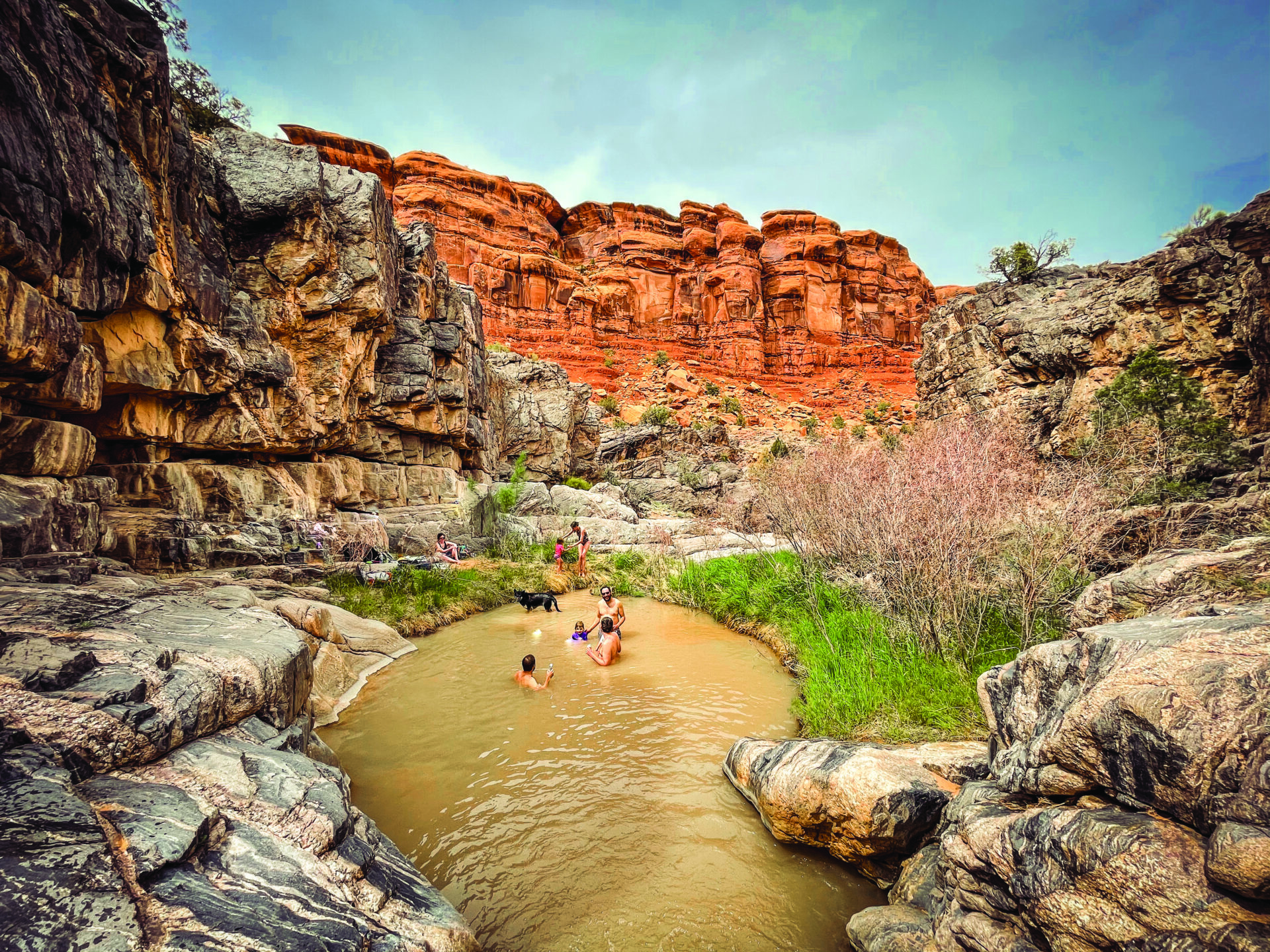
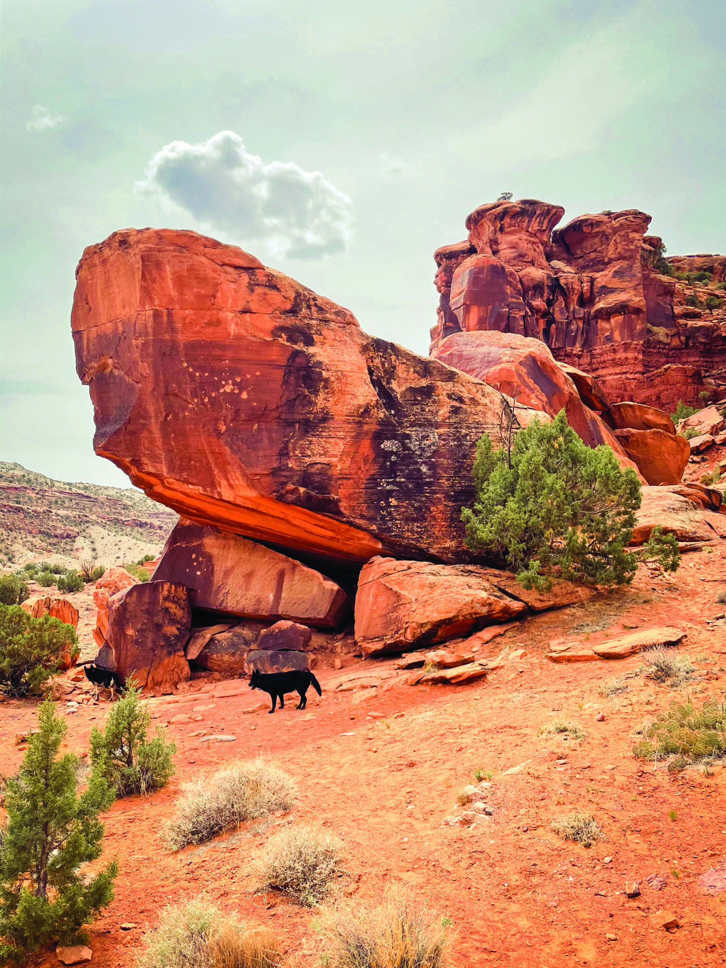
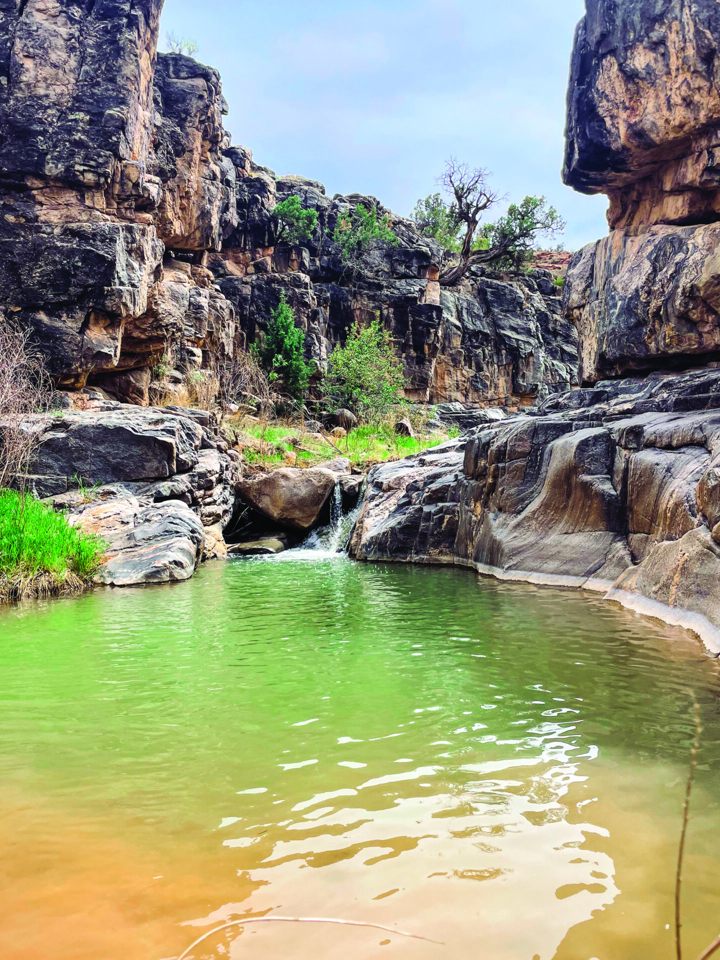
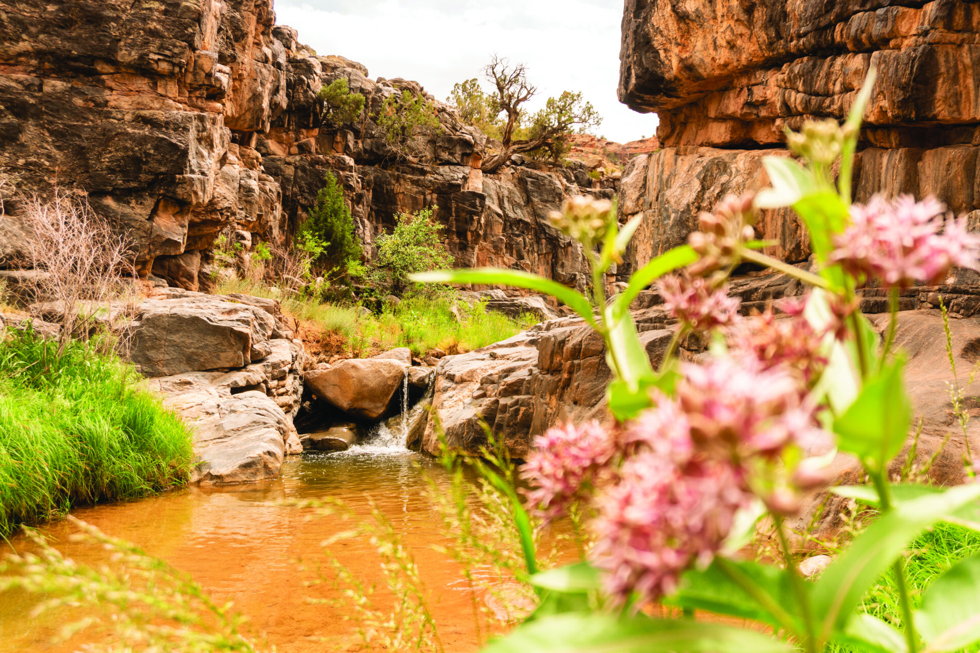
Starting along the Gunnison River, the path follows train tracks before it crosses a bridge and continues along a canyon wall upstream. Once the trail enters the wilderness area, huge, red rock formations and massive sandstone walls rise up from the desert landscape. Eventually, the trail turns into Big Dominguez Canyon, characterized by narrower canyon walls and a stream below with some swimming holes. Around three miles, a waterfall has created a lush oasis in the desert. Find a place to stop and swim or continue deeper into the canyon for more swimming pools, interesting geological features and rock art.
A 30-mile stretch of the Gunnison River takes boaters from Escalante Canyon to the Whitewater boat ramp. Most of the float is Class I and II rapids, as it passes through some 800-foot canyon walls and dramatic desert landscape.
There are ample opportunities for camping and hiking along the float. The river passes by the trailhead for Big Dominguez Canyon before it enters the wilderness area. Free, self-issue permits are required for overnight trips and can be obtained at the boat launch.
Miles of existing dirt roads and 4×4 trails within the area allow motorized recreation, making it an attractive destination for dirt bikes and side-by-sides. Bikes and motorized vehicles are not allowed in wilderness areas, so head to the northern or southern edge of Dominguez Escalante NCA to explore. Tabeguache Trail and Nine Mile Hill within the CactusPark area are popular trails.
Looking for relief from the hot Colorado sun? Stop at one of the swimming holes along the Big Dominguez Trail or visit the Potholes, an idyllic swimming spot consisting of small pools tucked along steep canyon walls. Located12 miles up Escalante Canyon Road, numerous swimming areas within the Potholes Recreation Area can be reached by scrambling down a smooth rock face. Swim with caution, as hidden currents in the Potholes can be dangerous and pull swimmers underwater, regardless of ability.
Several designated campsites with some facilities are available at the Potholes Recreation area; otherwise, there is dispersed camping on BLM land throughout the region. Continue past the Potholes Recreation Area on Escalante Canyon Road for dispersed campsites tucked against the canyon wall or overlooking the river below. Another option is Escalante Overlook Road, located a few miles north. This area has plenty of open land and a few spots perched on a cliff high above the Gunnison River. Just beware, many of the dispersed areas are filled with small cacti, so watch where you step and sleep.
Ready to head to Dominguez Escalante NCA? Hovering around 5,000 feet, the high desert plains stay mostly free of snow other than a few months in the dead of winter, but spring is the best time to explore the area. At this time, temperatures are warm but not yet sweltering and water levels are high enough to float the river and fill the watering holes for a refreshing dip.
Photos by Jennifer Weintraub.